R02 Pantano Navamuño - Llano Alto | Features
Route Technical Information
DIFFICULTY
MIDE Proyect: 2/1/1/2
DISTANCE
Round Trip Distance: 9.200 m
DURATION
Round Trip Duration: 2h 40min
SING POSTS
Route Indicative Signal Post: PURPLE
LONGITUDINAL PROFILE
Grade 167 m
SHADE/SUN
50% / 50%
Information
Detailed Route Information
1.
INFO
PRESENTATION
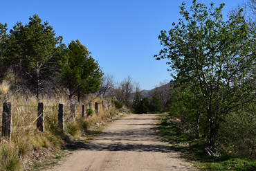
This is a good walk to do as a family, and is suitable all year round. The route doesn’t exert much energy and is along a well-kept path. You won’t really come across any risks, and the vegetation all the way makes the walk easier, since you will find areas of sun and shade alternatively throughout the whole walk.
There are several alternatives to the original route; for example, instead of going back and forth along the same path, you can make it a circular walk, or, as long as you have two cars, you can make it a one way walk, leaving one car at the beginning and the other at the end.
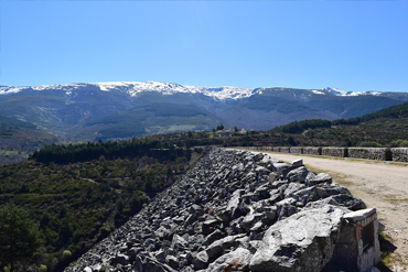
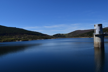
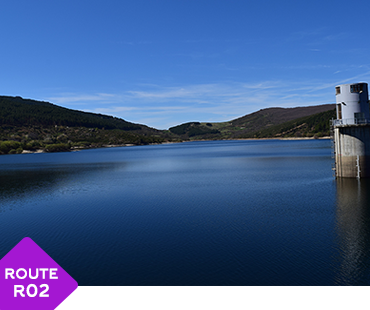
The route begins at the entrance to the “Pantano de Navamuño”, a reservoir which collects the water from the Angostura River (in the drainage basin of the Tagus river). Construction was completed in 1989, with a capacity of 14 cubic hectometres and a surface of 67 hectares, it is a dam which supplies water to about 30 municipalities in the region. Made with loose materials, you will be struck by the almost 70 metres of rock upon rock used to build the dam, which are supported by concrete. You can find out more about the reservoir if you take 10 minutes to look at the models / information boards, which are in a rest area not far from the start of the route (approximately 320 metres away). These boards explain the main elements of this type of infrastructure: reservoirs, diversion channels, waterfalls etc.
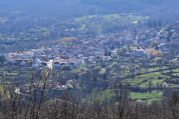
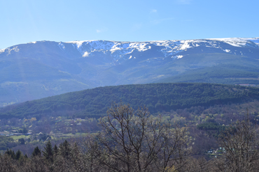
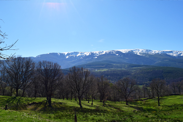
Once you’ve passed the reservoir, where you will be able to take some incredible pictures of the valley of the “Cuerpo del Hombre” river, you can follow the path to the right, and start to descend a well-kept path where you will enjoy walking through a forest of Scots pine trees, known for their unique Salmon colour.
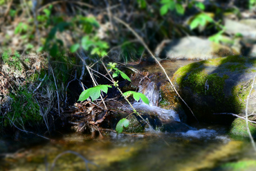
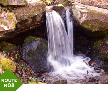
You will continue step by step until you arrive at several gates which lead to other walkways… a good example of the ingenuity of the local cattle breeders. Between two of the gates, leaving the path, you can take some good photographs of the water which forms the “Las Palomas” stream, where you will find a riverbank rich in vegetation (including Birch trees, Hazel trees, Hawthorns etc.).
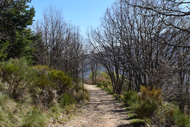
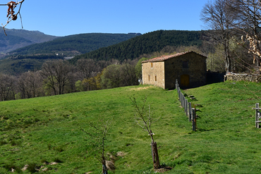
Continuing along the path, you will be surrounded by Chestnut and Oak trees until you reach the “Albergue de Llano Alto”, a youth hostel belonging to the Autonomous community of Castilla y León, thus ending the route.
Finally, to make this route circular, when you reach the hostel, you can choose to start route 7 - the “La Abeja” power plant – Llano Alto (black) where you will arrive at the natural pools of Candelario. From this point, if you turn right, you will go along the road which will take you directly to the Navamuño dam. If you choose this option, you will walk a little more (2900 metres of route 7 plus 4470 metres along the road, making it 7370 metres), but it is a good idea if you want to explore and make the most of the nature of the Candelario mountain range.
2.
INFO
TECHNICAL DATA
- Route type: Round trip
- Distance: 4.600 m Total: 9.200 m
- Time: 2 hours 40 minutes (no stops)
- Sing Post: Purple
- ***
- MIDE Proyect:
- Climb Grade:167 m
- Descent Grade:167 m
- Natural Environment Severity 2
- Guidance on the road 1
- Difficulty in displacement 1
- Effort required 2
- ***
- Recommended Time:
Spring / Summer / Autumn / Winter - Shade/Sun: 50% / 50%
- ***
- Interest Points (viewpoint, sculpture, river...):
- Start : Candelario
- Interest Point 1: Navamuño Reservoir Recreational Area
- Interest Point 2: Navamuño Reservoir
- Interest Point 3: Las Palomas Stream
- Ending: Albergue de Llano Alto
- ***
- Risky Points:
- Risky Point 1: Road
- ***
- Phone Numbers of Interest
- Phone Town Hall: 923 413 011
- Turism Office Phone: 923 413 420
- Emergency Phone: 112
- Police Phone: 062
- ***
- RECOMMENDATIONS
- Effort Required
- Drink water frequently and in small quantity
- Eat nuts or chocolate
- In the stops do not get cold
- Take your dog tied, there are cattle and wild animals
- Consult an environmental educator with knowledge of the environment
- Analyze the route according to your capacity
- Check the weather forecast
- Keep in good condition the roads and the walking trails. Avoid accidents, losses, and you must keep the beauty of the hiking routes
3.
INFO
READ BEFORE LEAVING
- PROHIBITIONS
- DO NOT light a fire and DO NOT cut firewood
- DO NOT leave or bury any kind of trash
- DO NOT change or remove elements from the natural environment
- DO NOT wash tools and cars in rivers, lakes, and streams
- DO NOT throw cigarettes into the natural environment
- DO NOT step on the land planted DO NOT cross the trails
- TIPS
- Hiking is not trekking, excursions or climbing
- Mandatory Individual Equipment You must wear mountain boots, socks and you must not forget water
- Sport Equipment
- . Breathable, Waterproof and Termal Sportswear, Pants and T-shirt
- . Capes, Raincoats
- . Warm Clothing (Gloves, Scart,..)
- . Hat or headscarf
- . Spare Clothes
- . Suitable footwear and spare socks
- Other necessary things (preventative)
- . Sunglasses
- . Sun Protection Cream
- . First aid kit
- . Walking sticks
- Provisioning
- . Water Bottle
- . Enough food
- Others
- . Backpack
- . Map of the area / Compass / GPS
- . Latern with backup battery
- . Mobile with backup battery
- . Reflective Vest
- OBLIGATIONS
- Follow the route and never leave the trail
- Respect the enclousures along the way. Remember that they own
- Wind and rain guard
- Use trash bins
- Use trash bins
- Camping at established locations
- Closes gates, bars and hut doors that you find
- Respect the sings
Routes by Candelario
In nature and urban
- Difficulty: LOW
- Duration aprox: 2 hours
- Distance: 7,2 KM - ROUND TRIP
- Videoguide English: VIEW
- Difficulty: LOW
- Duration aprox: 2:40 hours
- Distance: 9,2 KM - ROUND TRIP
- Videoguide English: VIEW
- Difficulty: LOW
- Duration aprox: 1:40 hours
- Distance: 5,5 KM - ROUND TRIP
- Videoguide English: VIEW
- Difficulty: AVERAGE
- Duration aprox: 1:25 hours
- Distance: 4,2 KM - ROUND TRIP
- Videoguide English: VIEW
- Difficulty: AVERAGE
- Duration aprox: 3 hours
- Distance: 9 KM - ROUND TRIP
- Videoguide English: VIEW
- Difficulty: LOW
- Duration aprox: 1:40 hours
- Distance: 5,8 KM - ROUND TRIP
- Videoguide English: VIEW
- Difficulty: LOW
- Duration aprox: 1:05 hours
- Distance: 3 KM - ROUND TRIP
- Videoguide English: VIEW
- Difficulty: LOW
- Duration aprox: Free
- Distance: CIRCULAR
- Videoguide English: VIEW
- Difficulty: LOW
- Duration aprox: 1:20 hours
- Distance: 4 KM - CIRCULAR
- Videoguide English: VIEW
