R05 Fuentasanta - La Muela| Features
Route Technical Information
DIFFICULTY
MIDE Proyect: 3/1/1/3
DISTANCE
Round Trip Distance: 9.000 m
DURATION
Round Trip Duration: 3h
SING POSTS
Route Indicative Signal Post: YELLOW
LONGITUDINAL PROFILE
Grade 374 m
SHADE/SUN
90% / 10%
Information
Detailed Route Information
1.
INFO
PRESENTATION
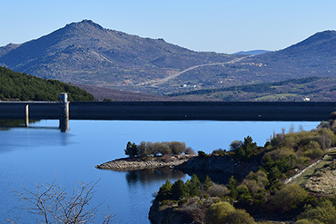
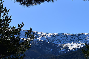
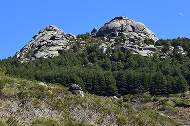
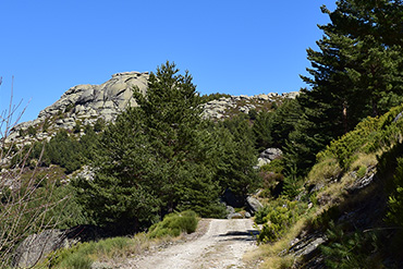
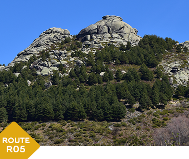
This route, which is of particular geological interest, will take you to the “La Muela” beauty spot, where you will be able to enjoys the views of the two granite mountain peaks, named the “Dos Hermanitos” (Two brothers). Here, you will be able to make out the Hoya Moros valley, which is of glacial origin.
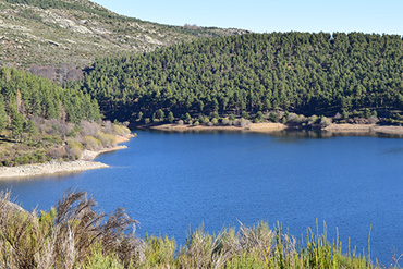
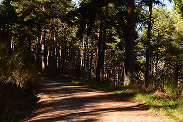
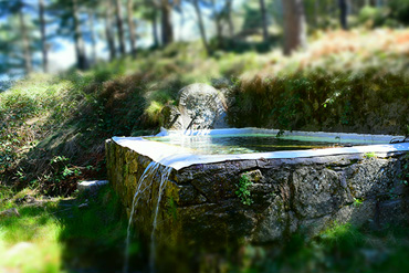
The route begins by car, from the “Humilladero” square in Candelario, which after a 6.8 kilometre journey, you will leave in the area which gives this route its name; “Fuentesanta” - literally the Saint’s fountain. Once ready for the trek, you will begin the walk, which is suitable all year round, with a gentle ascent along a path lined with a Scots pine forest, known for their typical salmon colour.
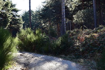
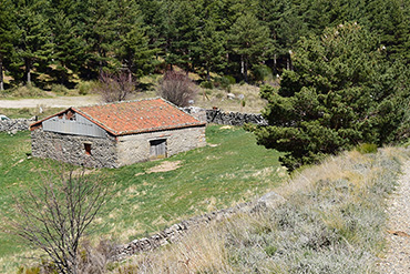
As you continue, without deviating from the road or the main trail, you will notice heather and broom shrubs, replacing some of the pine trees. These plants will indicate that you are climbing, increasing in altitude to reach your destination (at 1626 metres high). Along the way, you will notice different burnt areas, which has been done to break the continuity of the pine, so that in the case of a wildfire, it would not spread as far. When you have walked about 3 kilometres, you will arrive at a zone where you can take a break, to build up strength and enjoy the views and the pine trees around you.
Once you’ve rebuilt the strength needed to complete this route, 1500 metres remain from the rest area to reach “La Muela”, which you will discover after turning right onto a large track, made as a firewall. At the end of this path, you will see big rocks which define this spot. At this point, you will need to protect yourself from the sun and you will be likely to need a windbreaker to protect you from the wind at this altitude, although this will all depend on the time of year when you do this hike. Then on the granite rocks, you will be able to take in the splendour of the Ambroz and Candelario valleys, including the Navamuño reservoir.
If you don’t want to return the same way you came, you can make this a circular route, although this alternative option isn’t signposted and the path is rocky, so your feet will suffer more than they did along the other path (if you choose to walk this way, the distance from the end of the route until the car is 4800 metres).
2.
INFO
TECHNICAL DATA
- Route type: Round trip
- Distance: 4.500 m Total: 9.000 m
- Time: 3 hours (no stops)
- Sing Post: Yellow
- ***
- MIDE Proyect:
- Climb Grade:374 m
- Descent Grade:374 m
- Natural Environment Severity 3
- Guidance on the road 1
- Difficulty in displacement 1
- Effort required 3
- ***
- Recommended Time:
Spring / Summer / Autumn / Winter - Shade/Sun: 90% / 10%
- ***
- Interest Points (viewpoint, sculpture, river...):
- Start : NAvamuño Reservoir
- Interest Point 1: Pine forest
- Interest Point 2: The Muela
- ***
- Risky Points:
- Risky Point 1: Road
- ***
- Phone Numbers of Interest
- Phone Town Hall: 923 413 011
- Turism Office Phone: 923 413 420
- Emergency Phone: 112
- Police Phone: 062
- ***
- RECOMMENDATIONS
- Effort Required
- Drink water frequently and in small quantity
- Eat nuts or chocolate
- In the stops do not get cold
- Take your dog tied, there are cattle and wild animals
- Consult an environmental educator with knowledge of the environment
- Analyze the route according to your capacity
- Check the weather forecast
- Keep in good condition the roads and the walking trails. Avoid accidents, losses, and you must keep the beauty of the hiking routes
3.
INFO
READ BEFORE LEAVING
- PROHIBITIONS
- DO NOT light a fire and DO NOT cut firewood
- DO NOT leave or bury any kind of trash
- DO NOT change or remove elements from the natural environment
- DO NOT wash tools and cars in rivers, lakes, and streams
- DO NOT throw cigarettes into the natural environment
- DO NOT step on the land planted DO NOT cross the trails
- TIPS
- Hiking is not trekking, excursions or climbing
- Mandatory Individual Equipment You must wear mountain boots, socks and you must not forget water
- Sport Equipment
- . Breathable, Waterproof and Termal Sportswear, Pants and T-shirt
- . Capes, Raincoats
- . Warm Clothing (Gloves, Scart,..)
- . Hat or headscarf
- . Spare Clothes
- . Suitable footwear and spare socks
- Other necessary things (preventative)
- . Sunglasses
- . Sun Protection Cream
- . First aid kit
- . Walking sticks
- Provisioning
- . Water Bottle
- . Enough food
- Others
- . Backpack
- . Map of the area / Compass / GPS
- . Latern with backup battery
- . Mobile with backup battery
- . Reflective Vest
- OBLIGATIONS
- Follow the route and never leave the trail
- Respect the enclousures along the way. Remember that they own
- Wind and rain guard
- Use trash bins
- Use trash bins
- Camping at established locations
- Closes gates, bars and hut doors that you find
- Respect the sings
Routes around Candelario
In nature and urban
- Difficulty: LOW
- Duration aprox: 2 hours
- Distance: 7,2 KM - ROUND TRIP
- Videoguide English: VIEW
- Difficulty: LOW
- Duration aprox: 2:40 hours
- Distance: 9,2 KM - ROUND TRIP
- Videoguide English: VIEW
- Difficulty: LOW
- Duration aprox: 1:40 hours
- Distance: 5,5 KM - ROUND TRIP
- Videoguide English: VIEW
- Difficulty: AVERAGE
- Duration aprox: 1:25 hours
- Distance: 4,2 KM - ROUND TRIP
- Videoguide English: VIEW
- Difficulty: AVERAGE
- Duration aprox: 3 hours
- Distance: 9 KM - ROUND TRIP
- Videoguide English: VIEW
- Difficulty: LOW
- Duration aprox: 1:40 hours
- Distance: 5,8 KM - ROUND TRIP
- Videoguide English: VIEW
- Difficulty: LOW
- Duration aprox: 1:05 hours
- Distance: 3 KM - ROUND TRIP
- Videoguide English: VIEW
- Difficulty: LOW
- Duration aprox: Free
- Distance: CIRCULAR
- Videoguide English: VIEW
- Difficulty: LOW
- Duration aprox: 1:20 hours
- Distance: 4 KM - CIRCULAR
- Videoguide English: VIEW
